
Meriwether Lewis Becomes First Anglo-American to Ascend the Continental Divide: August 12, 1805

This text comes from our book, Lands of Hope and Promise.
On April 6, 1805, the corps resumed its journey. Continuing up the Missouri, they passed through hilly lands and then into barren country where were no signs of men. The Missouri now flowed between perpendicular black granite cliffs, 1,200 feet high. Jutting skyward reared “large irregular masses of rocks and stones.” Herds of deer and elk thinned, and buffalo were seen no more in this bleak, frowning, though beautifully sublime land. By late May the expedition had reached a place where, for the first time, they could see the Rockies.
Reaching a great fork in the Missouri, the corps divided into two parties, each following a tributary to discover which was the principal stream. Lewis’ party, with Sacagawea, followed the northern fork, which he named Maria’s River (now the Marias), while Clark followed the southern fork, which proved to be the main stream of the Missouri. Proceeding up this fork, by mid June the expedition reached the great falls of the Missouri. The passage around the falls proved most difficult; the explorers suffered from hailstorms; the terrain was broken, the country infested with prickly pear cactus and grizzly bears. It was not until July 4 that the explorers completed the passage. They celebrated their victory, and Independence Day, by drinking off the last barrels of spirits and dancing into the night.
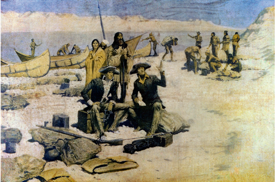
Lewis had hoped that the Rockies would demand only a single passage over high country. What was his disappointment, then, when, on August 12, having become the first Anglo-American to ascend the Continental Divide, he saw before him “immense ranges of high mountains still to the West of us their tops covered with snow.” Six days later was Lewis’ 30th birthday; marking the occasion in his journal, he mulled over the meaning of his life. He reflected that he had “as yet done but little, indeed, to further the happiness of the human race or to advance the information for the succeeding generation.” With “regret” he viewed:
. . . the many hours I have spent in indolence . . . but since they are past and cannot be recalled, I dash from the gloomy thought, and resolved in the future, to redouble my exertions and at least endeavour to promote those two primary objects of human existence by giving them the aid of that portion of talents which nature and fortune have bestowed on me; or in the future, to live for mankind, as I have heretofore lived for myself.
The day before Lewis’ birthday, his party had met a band of Shoshone whose chief, Cameahwait, turned out to be Sacagawea’s brother. The Shoshone were a Plains tribe that the Sioux had pushed into the mountains. Short in stature, these Indians wore a costume of animal skins; tufts of their defeated enemies’ hair fringed their boots.

Though the Shoshone held absolute sway over their wives and daughters, their government, wrote the explorers, was “perfectly free from restraint. Each individual is his own master, and the only control to which his conduct is subjected, is the advice of a chief supported by his influence over the opinions of the rest of the tribe.” Through Sacagawea, Lewis and Clark were able to secure horses from Cameahwait for the difficult descent of the Rockies.
Commencing this descent, the Corps of Discovery passed through the lands of the Nez Percé (“Pierced Nose”) nation and of the Flatheads, so named because of their practice of compressing the heads of infants between two boards to give them a flattened appearance. The food for the expedition was the typical Indian fare of the region — roots, salmon (now abundant in the rivers), and plump dogs.

The party discovered that the Indians of the Pacific were different from those of the Plains. They were, according to Clark, short and bowlegged. They lived in long, wooden plank lodges — sometimes over 200 feet long — that often housed several families. They plied the rivers in long canoes, expertly made from redwood. Lewis and Clark discovered that women had a higher station among these tribes than among those east of the Rockies — “they were permitted to speak freely before the men, to whom indeed they sometimes address themselves in a tone of authority.” Chinook, Tillamook, Kalamath, and Clatsop were the names of some of these Pacific coast tribes. Following the Columbia, the Corps of Discovery had passed beyond the limits of the Louisiana Purchase territory and entered the Oregon Country — lands claimed by both Great Britain and Spain. When at last the corps had reached the Pacific Ocean, they chose a site amid the misty forests of the Oregon coast for their winter quarters, raising log structures and a palisade they called Fort Clatsop. There they remained until March 23, 1806, when they began their homeward journey.
Passing again over the Rockies, Lewis and Clark parted ways, as they had done on the westward journey; the former, with a part of the company, moved north to the Marias River, while Clark went south by way of the Jefferson and Yellowstone Rivers. Uniting again at the junction of the Little Missouri and Missouri Rivers, the expedition continued down river to the Mandan village, where they parted with Sacagawea. Descending the Missouri, Lewis and Clark reached their point of embarkation, St. Louis, on September 23, 1806. The following February found them reporting to President Jefferson in Washington.


